Aerial property documentation • Elk Grove, California

Professional Drone Services in Elk Grove, CA

High-resolution aerial photography and visual property documentation for roofs, storm damage, real estate, construction, solar panels, land, commercial properties, and hard-to-reach exterior areas.

Serving Elk Grove, CA and surrounding Sacramento-area communities.

High-Resolution ImageryResidential & CommercialProfessional Digital Documentation

Property imaging services

Roof & property drone imaging in Elk Grove

Clear aerial photos and video help create an organized visual record of observable exterior property conditions—without unnecessarily placing people on roofs, ladders, or difficult-to-access areas.

01

Roof & Property Imaging

Capture detailed aerial views of roofs, gutters, drainage areas, exterior structures, and property features that can be difficult to see clearly from ground level.

  • Roof condition imagery
  • Gutters & drainage
  • Residential & commercial
02

Storm & Damage Documentation

Create clear photo and video records of observable exterior property conditions following storms, fire events, or other property damage.

  • Visible exterior conditions
  • Before & after records
  • Claim-supporting imagery
03

Real Estate Aerial Photography

Show residential and commercial properties from a perspective traditional ground photography cannot provide with professional aerial photos and video.

  • Property overviews
  • Listing imagery
  • Aerial photo & video
04

Land & Parcel Documentation

Create visual overviews of land, large properties, and development areas for documentation and record keeping—not surveying or boundary determination.

  • Land overviews
  • Large properties
  • Development areas
05

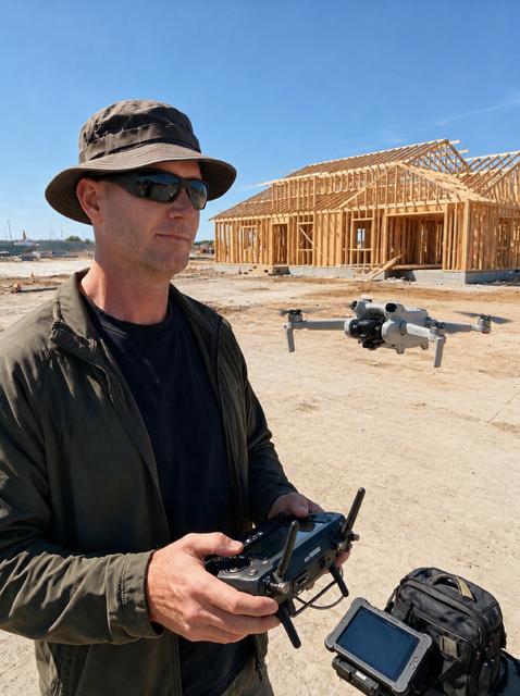
Construction Progress

Build repeatable visual records throughout a project to document site conditions, progress, and major milestones.

  • Milestone imagery
  • Repeat documentation
  • Site overviews
06

Solar Panel Visual Imaging

Document visible rooftop solar-array conditions from an elevated perspective without claiming electrical, thermal, engineering, or performance analysis.

  • Rooftop arrays
  • Visible conditions
  • Exterior documentation
07

Vegetation & Defensible Space

Capture property overviews, vegetation, and perimeter conditions for clear visual documentation—not compliance certification.

  • Vegetation imagery
  • Property perimeter
  • Current-condition records

Important scope note: Aerial imagery provides visual documentation only. It does not replace evaluation by a qualified engineer, adjuster, surveyor, electrician, roofing professional, licensed inspector, or other relevant professional.

Why Liberty

Professional aerial property documentation

Practical imagery, organized for review and record keeping.

See What You Can’t Easily Reach

Capture detailed views of roofs, gutters, solar panels, exterior structures, land, and other difficult-to-view property areas.

Document Conditions Clearly

Create a visual record before repairs, after storms, during construction, or whenever property conditions need to be documented.

High-Resolution Deliverables

Receive organized digital photographs and video that can be reviewed, stored, compared, or shared.

Residential & Commercial

Support homeowners, contractors, property managers, real estate professionals, construction teams, and commercial property owners.

Common use cases

When drone documentation makes sense

Drone imagery can help whenever current exterior conditions, progress, or changes need to be recorded from a clear elevated perspective.

  • After a major storm
  • Before or after roof repairs
  • Preparing a property listing
  • Before purchasing property
  • Monitoring construction progress
  • Documenting exterior damage
  • Reviewing visible solar-panel conditions
  • Recording current property conditions
  • Documenting vegetation and defensible space
  • Capturing commercial property imagery
  • Documenting land
  • Creating before-and-after records

A straightforward process

How drone service works

From the first conversation to organized digital delivery, every project starts with the property and the documentation you need.

  1. 01

    Tell Us What You Need

    Provide the property location and explain what needs to be photographed or documented.

  2. 02

    We Capture the Property

    Liberty Drone Services captures the requested high-resolution aerial photos and/or video when conditions allow.

  3. 03

    Receive Your Documentation

    Receive organized digital imagery for review, sharing, comparison, or record keeping.

Flight feasibility comes first.

Operations can depend on weather, airspace restrictions, site conditions, property access, safety considerations, and applicable aviation regulations. Not every requested flight can be conducted immediately—or at all.

Responsible operations

Professional imaging.
Responsible operations.

Each project is evaluated before flight for the location, site conditions, weather, airspace, property access, flight feasibility, and safe operating conditions.

Discuss your property

Questions, answered

Drone service FAQ

Clear answers about aerial property imaging in Elk Grove and the surrounding area.

Have another question? Email us
What does Liberty Drone Services do?

Liberty Drone Services provides professional drone photography, aerial property imaging, and visual property documentation for residential and commercial properties in Elk Grove, CA and surrounding Sacramento-area communities. Services include roof and exterior imaging, storm-condition documentation, real estate photography, construction progress imagery, solar-panel visual documentation, and land overviews.

What can Liberty Drone Services photograph?

We can photograph roofs, gutters, drainage areas, exterior buildings, rooftop solar panels, land, construction projects, residential properties, commercial properties, and other exterior areas where drone operation is appropriate.

Can drone photography help document storm damage?

Yes. High-resolution aerial imagery can provide a visual record of observable exterior property conditions after a storm when safe flight conditions permit. This imagery does not determine insurance coverage, repair cost, damage value, cause, or structural safety.

Can you inspect my roof?

Liberty Drone Services provides roof imaging and visual documentation. Detailed imagery can then be reviewed by you or a qualified professional. This service is not a licensed structural, engineering, roofing, or home inspection.

Do you provide insurance documentation?

We can produce photos and video of visible exterior conditions that customers may use when communicating with contractors, property professionals, and insurance professionals. Liberty Drone Services does not act as an insurance adjuster, claims representative, or coverage specialist.

Do you provide real estate drone photography in Elk Grove?

Yes. Liberty Drone Services provides aerial property photos and video for Elk Grove real estate, including residential listings, commercial properties, land, exterior features, and broader property context.

Can you document construction progress?

Yes. Repeat aerial photography can create clear visual records of project progress, site conditions, major milestones, and before-and-after changes.

Can you photograph solar panels?

Yes. Aerial imagery can document visible rooftop solar-panel conditions without requiring someone to climb onto the roof solely to obtain photographs. It does not constitute electrical inspection, engineering analysis, thermal analysis, or solar-output testing.

Do you provide commercial property drone photography?

Yes. Liberty Drone Services provides aerial imagery for commercial properties, exterior structures, construction sites, land, and other appropriate locations.

What happens if weather prevents the flight?

Safe operating conditions take priority. Flights may need to be delayed or rescheduled because of weather, airspace restrictions, site conditions, property access, safety considerations, or applicable aviation regulations.

What areas do you serve?

Liberty Drone Services primarily serves Elk Grove, CA and surrounding Sacramento-area communities. Contact us with your property location to confirm availability.

How do I request service?

Call 530-646-5862, email libertydroneservices@outlook.com, use any Request Service link on this page, or contact Liberty Drone Services through Facebook.
Start a conversation

Need aerial property documentation?

Tell Liberty Drone Services what you need photographed or documented, and we’ll help determine the best approach for your property in Elk Grove or the surrounding area.

Privacy

This website does not use contact forms, advertising trackers, analytics, or cookies. If you choose to call, email, or contact Liberty Drone Services through Facebook, those services process information under their own policies. Cloudflare and hosting infrastructure may retain limited technical or security logs needed to deliver and protect the site.